A ROSEDALE NEIGHBORHOOD HISTORIC WALKING TOUR
“Rosedale's Hidden History – The Early Years”
“Please join us as we learn more about Rosedale’s early history, people and buildings. RCA & CHRS also welcome your memories and stories of Rosedale - so come along on the tour and add what you know, or contact us beforehand to tell us about Rosedale’s history and we’ll add it into the tour dialogue”
SATURDAY - MAY 30, 2009
• Tour promptly begins at 11AM at the corner of 17th & Gales Street, NE(Rosedale Recreation Center)

(click on map for a larger view)
• Light refreshments and a tour handout will be provided
• For general event information or to submit historical information about the Rosedale neighborhood, contact Dana - 571.213.1630 or rosedaledc@gmail.com
TOUR ROUTE INCLUDES
• 1600 block of Kramer St.
• 1600 block of Rosedale St.
• 1500 & 1600 block of Gales St.
HISTORICAL TOPICS INCLUDE*
Architectural History
• Building Styles
• Architects & Builders
Rosedale Neighborhood History
• Columbia Railway (trolley)
• Camp Barry - A Civil War Camp
• Original Land Owners
• Mamie ‘Peanut’ Johnson
Neighborhood Demographics & Social Fabric
• Profile of Early Residents
• Alley Dwelling Life
* Please note: this is neither a comprehensive history of the Rosedale community nor does it encompass the entire Rosedale neighborhood. The tour focuses on what CHRS believes, based on research, to be the oldest developed area of the Rosedale neighborhood. Our hope is this event inspires Rosedale residents to want more historic tours and participate in providing and collecting historic information about the neighborhood.
Below are few historic Rosedale neighborhood maps excerpted from larger historical maps retrieved from the David Rumsey Cartography Associates Map Collection.
The site has a fantastic base and overlay city map and GIS browser, check it out.

Rosedale Area circa 1851(click on map for a larger view)

Rosedale Area circa 1861(click on map for a larger view)

Rosedale Area circa 1862(click on map for a larger view)

Rosedale Area circa 1887(click on map for a larger view)

Rosedale Area circa 1897(click on map for a larger view)

Rosedale Area circa 1909(click on map for a larger view)
Below are excerpts from Baist's Surveys of Washington, Real Estate Atlas of the District of Columbia through Victorian Secrets of Washington, DC website.

Rosedale Area circa 1903(click on map for a larger view)
This area was extracted from 1903 Baist's Survey Map, Plate 31 - Click HERE to view the entire plate.

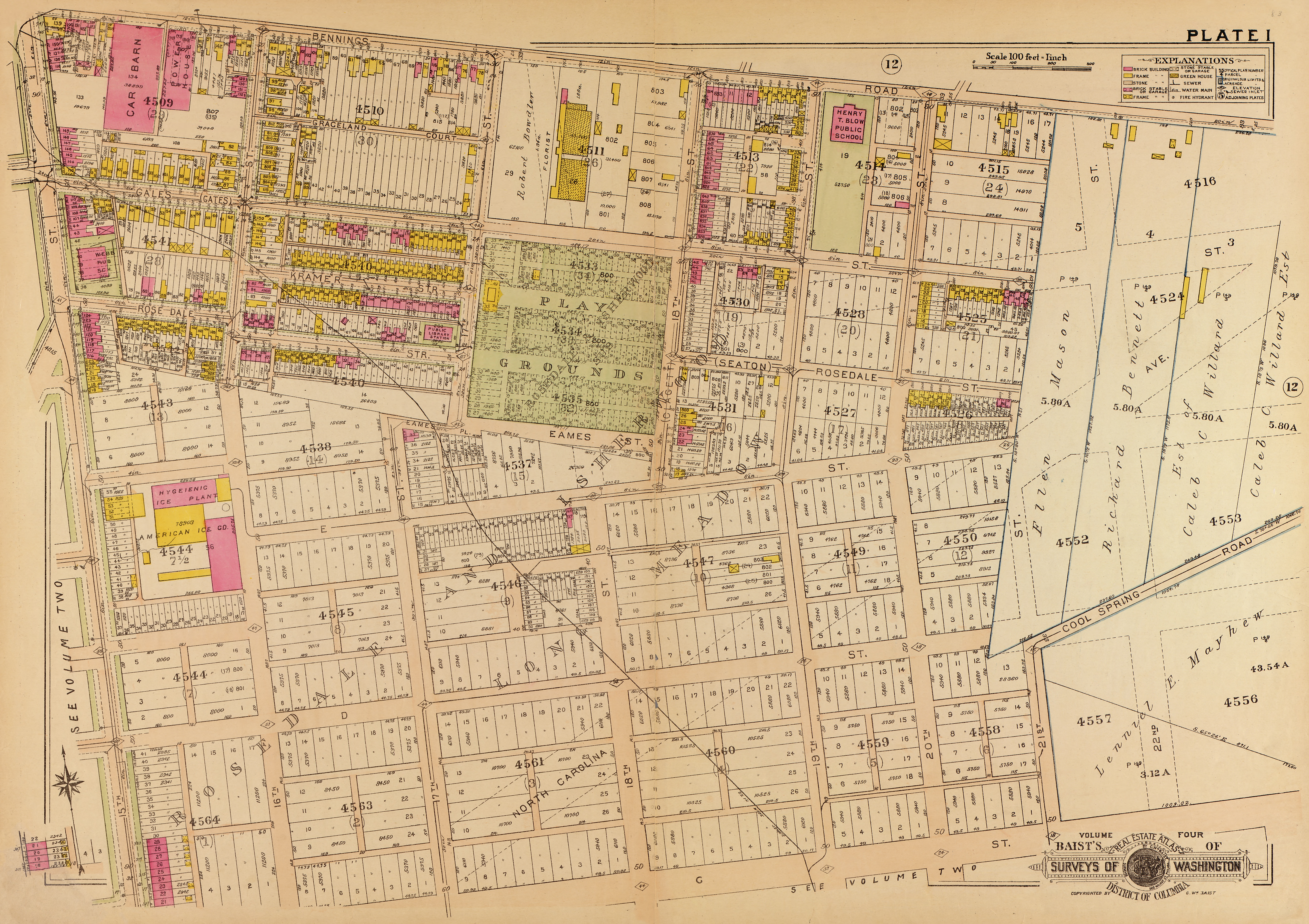
Rosedale Area circa 1919(click on map for a larger view)
This area was extracted from 1919 Baist's Survey Map, Sheet 1 Rosedale - Click HERE to view the entire sheet.
No comments:
Post a Comment